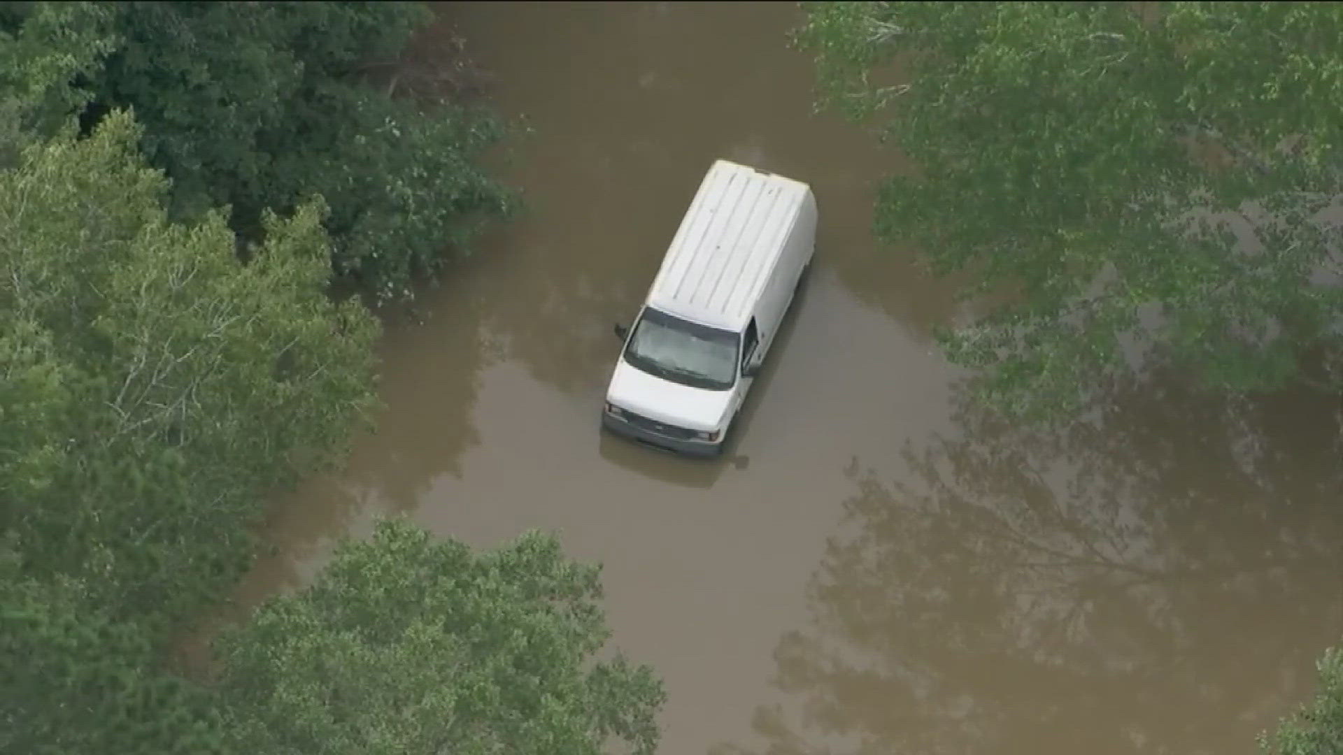
ATLANTA — Hurricane Helene ravaged much of the southeast this past week, killing at least 56 people, causing widespread destruction, and leaving millions without power.
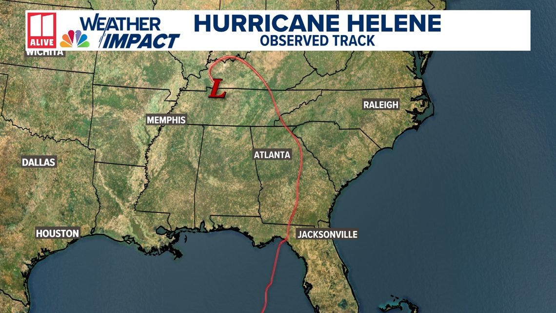
Helene made landfall late Thursday, September 26, as a major category 4 hurricane in the Florida Big Bend region just east of the mouth of the Aucilla River. At landfall, maximum sustained winds were 140 mph. It turned northward as it entered the state of Georgia, steered by a large area of low pressure to the west.
This is the observed track of the center of circulation of Hurricane Helene.

Days ahead of Helene's landfall, forecasters with the National Hurricane Center were able to pinpoint with remarkable precision where Helene would make landfall and how great the impacts would be, especially when it comes to storm surges along the Florida coast.
Was the forecast for Hurricane Helene perfect? Of course not. Completely nailing a hurricane forecast is nearly impossible, which is why the cone of uncertainty is used. It shows a range of possibilities.
This is the forecast released by the NHC at 11 a.m. on Tuesday, September 24, shortly after Helene was upgraded to a tropical storm.

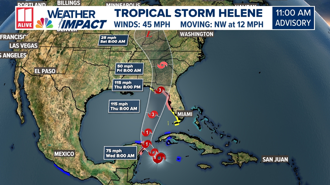
As Helene strengthened in the Gulf of Mexico, small changes were made to the forecast track and strength, but the overall consistency remained.
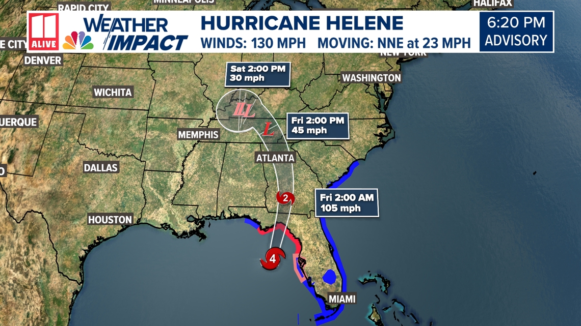
This is one of the last advisories released Thursday before landfall. Helene's center of circulation wobbled east as it moved through Georgia, so the observed track was along the outereast border of the cone of uncertainty.

Many through Florida and Georgia have noted that the worst of Helene was further east than predicted. Early forecasts from the NHC also underestimated the strength of Helene, although it was accurately predicted more than 24 hours before landfall.
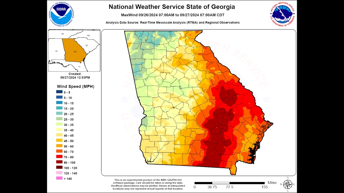
The strongest winds associated with tropical systems in the Atlantic are typically to the east of the center of circulation, often referred to as the "dirty side". Because of this, even small shifts in the center of circulation can have big impacts.
A swath of 60-100 mph wind gusts extended from Echols County in south Georgia through Hart County in northeast Georgia. The strongest winds from Helene were across the eastern portion of the state.
Wind gusts to the west of the center of circulation ranged from 25 mph to 50 mph. In the northwest corner of the state, wind gusts were not nearly as strong.