

ATLANTA — Francine has made landfall as a Category 2 Hurricane in southern Louisiana in the Parish of Terrebonne. This is about 30 miles southwest of Morgan City. Maximum sustained winds were estimated to be near 100 mph.
At 11pm Wednesday, it was downgraded to a tropical storm. Max winds were at 70mph which is just below hurricane strength.

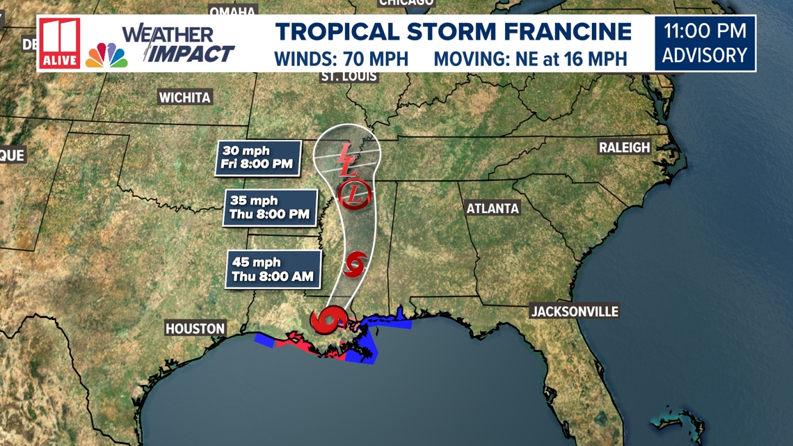
After landfall, Francine is forecast to veer further northward. It will weaken as it moves through Mississippi. The remnants will settle over Tennessee.
Will the system impact Georgia?
Although the center of circulation will be well to our west, tropical moisture will extend far eastward outside the center. The remnants of Francine will send rain, wind, and a low tornado risk to our area for the end of the week.
Since we are on the wetter right hand side of the track, we need to watch for rain and even the potential for storms to develop. Rain is most likely in north Georgia Thursday and Friday.
Wednesday should remain mostly dry in our area. A few showers are possible, mainly in the afternoon south of I-20.

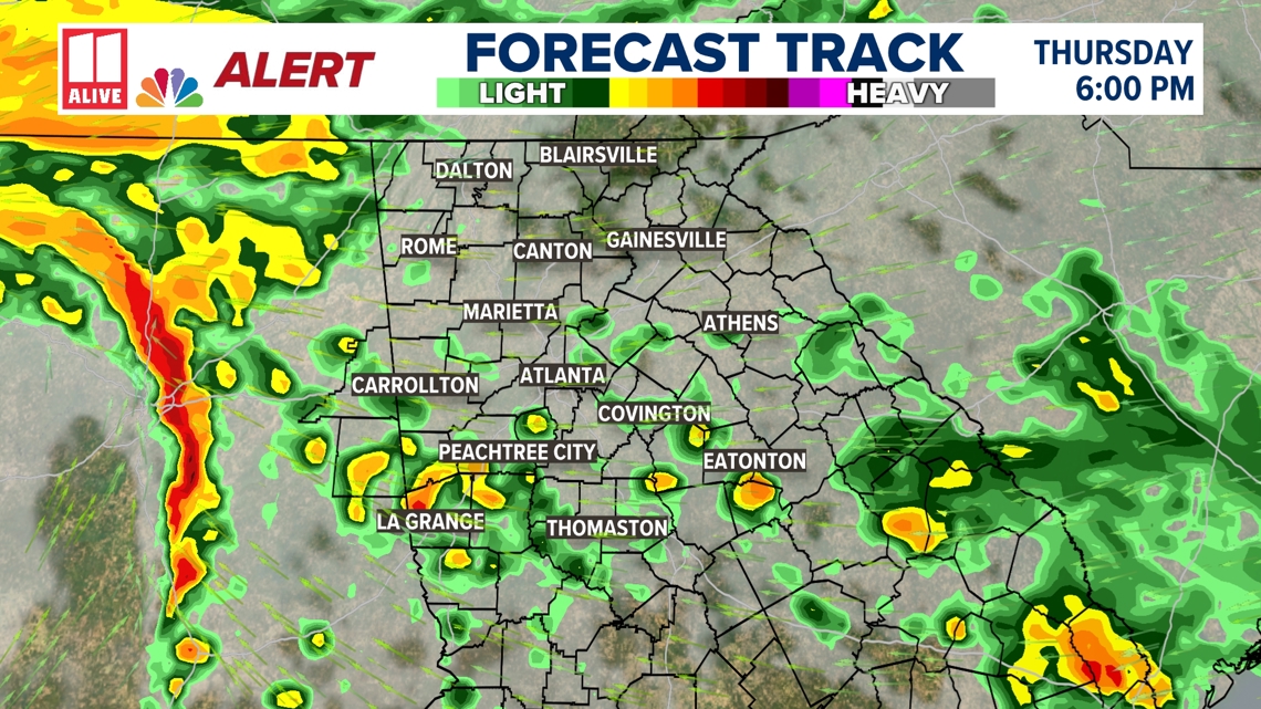
By Thursday, the rain moves into Georgia and the metro area, and it could be heavy at times.
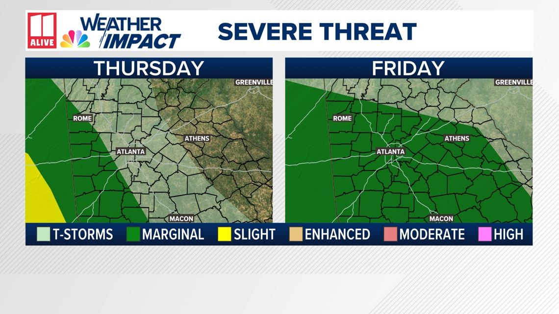
There is a very low threat for an isolated tornado Thursday and Friday, so we will be monitoring storms closely. Stay weather aware.
There is a Level 1 threat of severe weather for west Georgia Thursday, and Level 1 threat for much of the area on Friday.

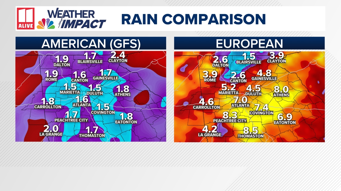
Rain will linger through Saturday, and possibly into Sunday as well. Many will pick up 1" - 3" of rain, and some locally higher totals are possible. Models still widely disagree with how quickly the moisture moves out of our area. Notice the European Model still highlighting a higher rainfall potential. Right now, we feel this is an outlier, but something we will watch.

There are several other areas in the Atlantic we're watching, including newly formed Tropical Depression Seven in the eastern Atlantic.
Sept. 10 is the statistical peak of hurricane season. We expect it to remain active at least through mid-October. It should slow down a little more from mid-October to the end of hurricane season on Nov. 30.