
ATLANTA — Debby made landfall as a Category 1 hurricane around 7:00 a.m. Monday near Steinhatchee, Florida with winds of 80 miles per hour.
Debby is now moving through southeast Georgia. Debby will make an eastward turn as it moves inland, steered by a stalled front draped across the southeast. It will weaken and slow to a crawl, dumping more than 10 inches of rain across the coast of Georgia and into the Carolinas. It will then potentially re-emerge in the Atlantic mid-week before turning to the north and moving up the east coast.
The storm will continue to move slowly over the next few days. As of the 11 a.m. advisory, Debby is a tropical storm with 40 mph sustained winds moving ENE at 6 mph. This path continues to bring heavy rain for south Georgia and into the Carolinas.

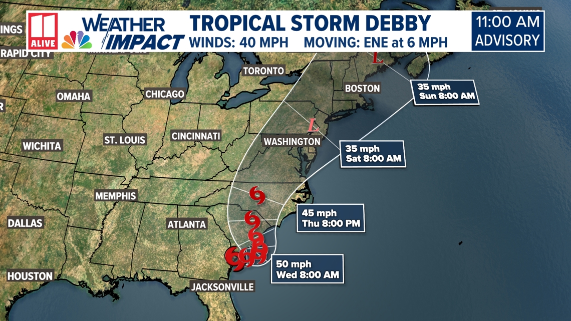
The forecast is fluid, so it will be worth monitoring. The storm is forecast to stay to the east of north Georgia and mainly impact South Carolina, but if this changes, we will keep you updated.
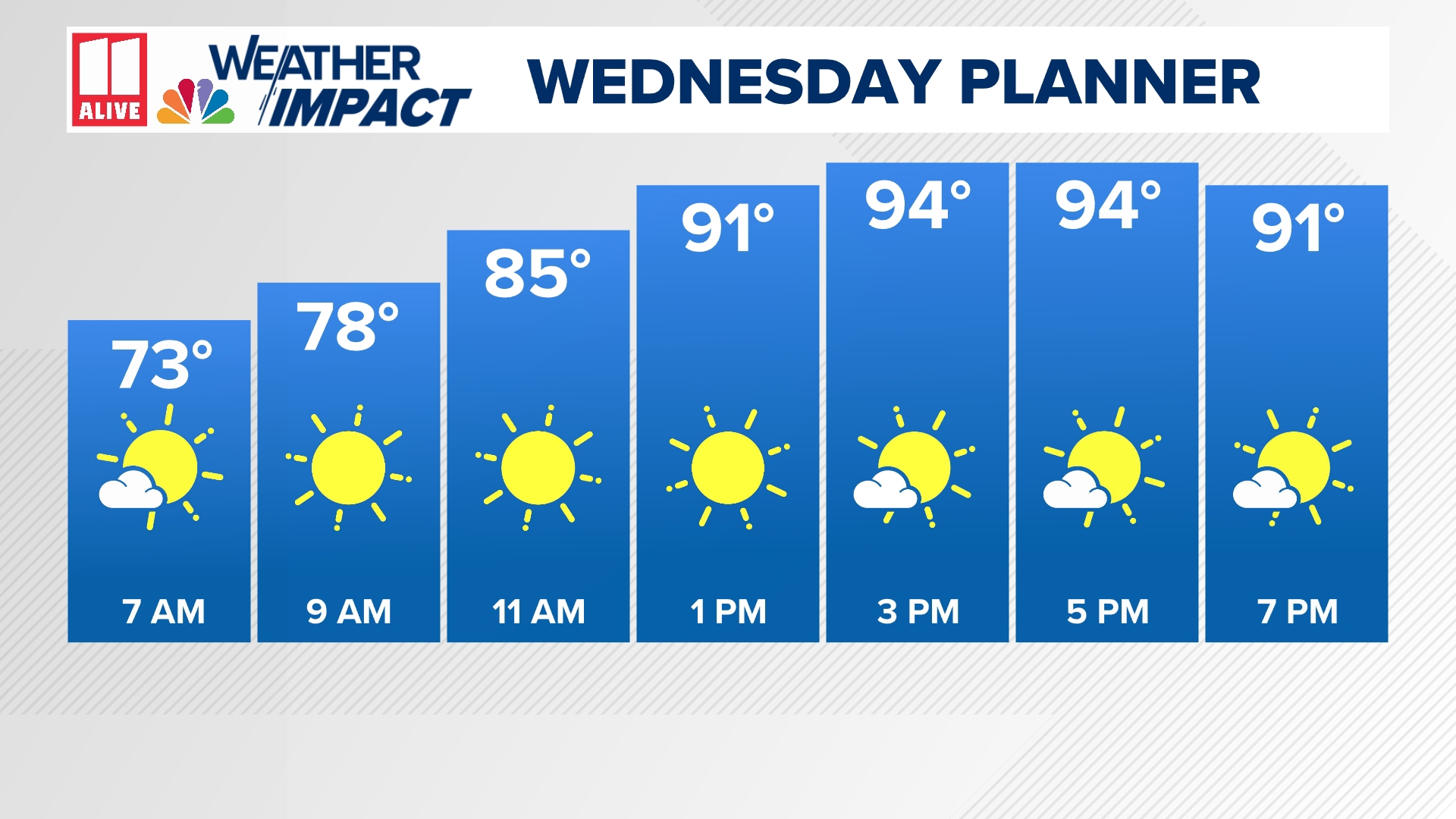
Winds may also get a little breezier for Tuesday afternoon, but sustained winds will likely stay in the 5-15 mph range.

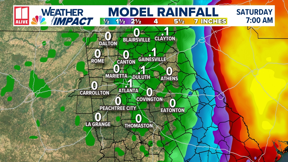
The west side of the center of circulation of a tropical system is historically the drier side, and it looks like we will stay on the drier side of Debby, before it starts to pull away on Thursday. Any westward shift would bring more rain to our area, but right now impacts here will be low. Rain chances remain at only 20%.
Rain potential is lower mid-week as Debby pushes east, but we may have a second opportunity at tropical moisture for the end of the week.

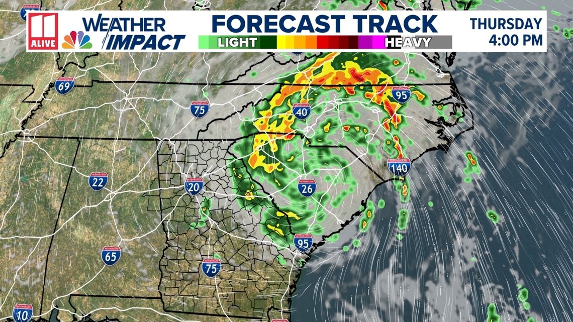
Model guidance brings the center of circulation westward as it slows on the Atlantic coast. This would lead to significantly more rainfall across coastal Georgia and the Carolinas. Anyone with plans to travel to the Georgia, Florida, or Carolina coast this week should closely monitor the forecast. The main reason this will happen is due to weak steering for the system due to two areas of high pressure.
Right now, areas southeast of Atlanta will have the best chance to see heavy rain at times. The most widespread rain, however, will stay to our south in central and south Georgia.. It will be a sharp cutoff between picks up on tropical rain and who stays primarily dry.
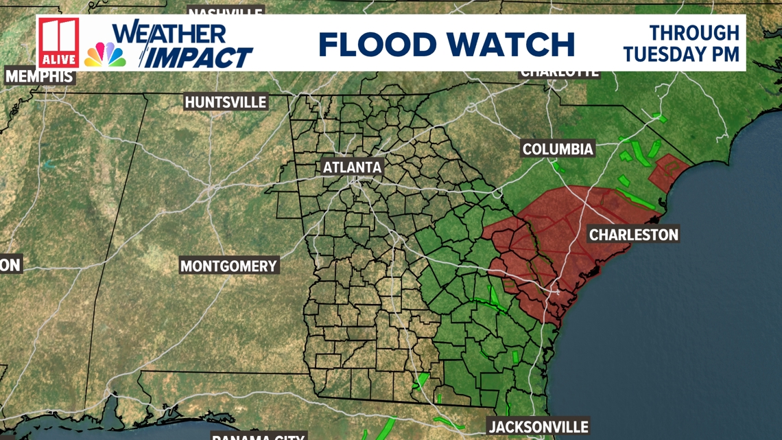
In addition to the tropical watches and warnings that have been issued along the coast, a Flood Watch will be in effect through Tuesday evening for portions of central and south Georgia.

We will be watching closely as confidence in the forecast grows. This is a quickly evolving forecast. Stay tuned!