ATLANTA — UPDATE: Good news for Georgia - in a 9 a.m. update, the National Weather Service broadly downgraded the threat. For more on that visit our live updates blog.
Original story below
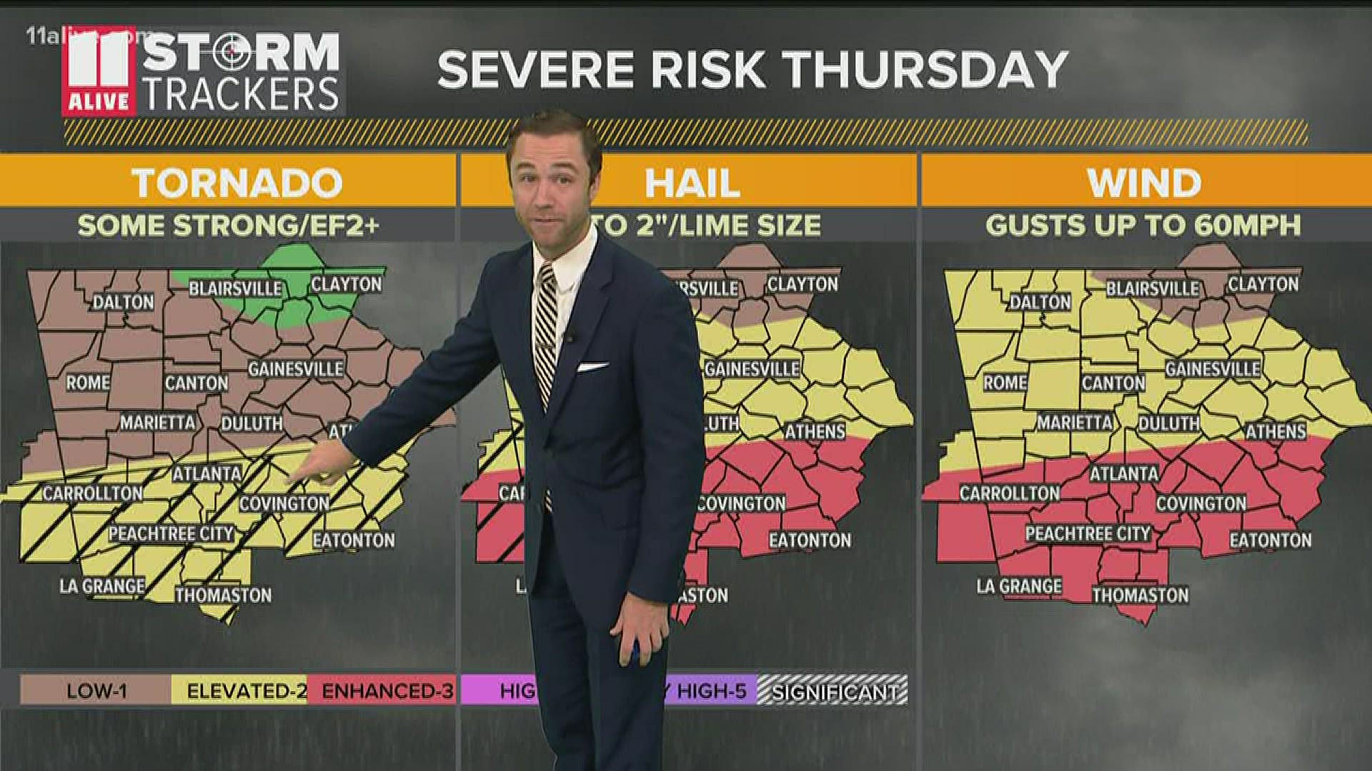
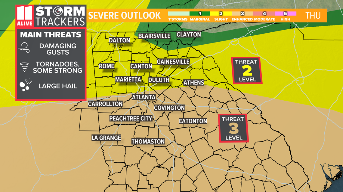
Thunderstorms on the way today, with the National Weather Service placing much of Georgia under either a level two or level three threat for severe weather.
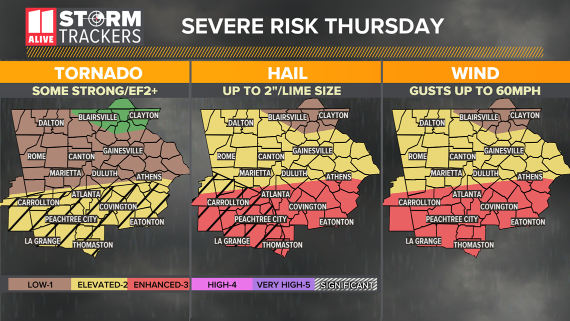
The systems could bring wind gusts up to 60 mph, tornadoes (some possibly strong), and golf ball sized hail in the level three threat area, according to 11Alive Meteorologist Wes Peery.
The latest projections put much of the north Atlanta metro in a level three, but then the threat transitions to a level two the further north you go.

Here's a basic timeline of how you can expect the day to progress:
Morning
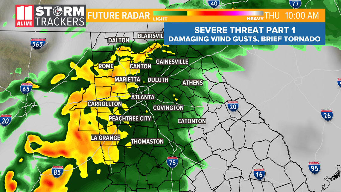
A first round of showers and storms will move through during the morning hours. This round has the potential for heavy rain and strong winds. The tornado risk with the first round is very low.

Afternoon
The best chance for severe storms will be in the afternoon and evening along and just ahead of the cold front. The later period would start to develop around 4 p.m. in western Georgia, according to the forecast models.
In order for this to happen, the sun will have to come out and temperatures warm into the upper 60s to lower 70s.
Another possibility is that storms to the south will rob our storms of moisture.
If the sun comes out and southern storms don't impact us, we would likely see a second and potent round of severe storms.
That second round could also have heavy rain, damaging wind, large hail(western GA) and even strong tornadoes(near/south of I-20).


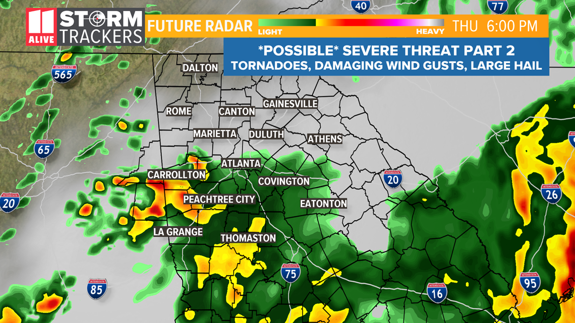
Thursday evening
The severe weather threat could continue into the night depending on if the environment does recover enough for it to develop in the first place, which is still an open question.
Please monitor the forecast for changes!
Download the FREE app now in the iTunes store or on Google Play.
POWER OUTAGES CHECK | Georgia Power customers, check here. Georgia EMC customers check here.
MORE HEADLINES

