
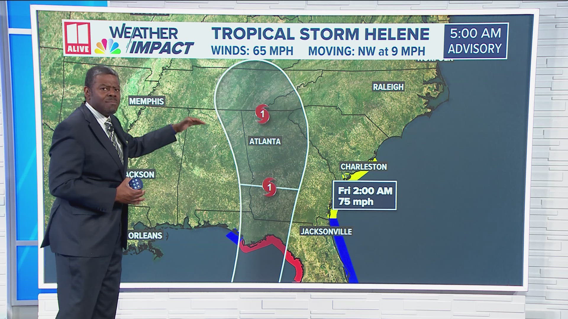
ATLANTA — Tropical Storm Helene formed in the Caribbean Sea Tuesday morning. It is strengthening as it moves past the Yucatan Peninsula. Helene is producing sustained winds of 65 mph with stronger gusts as it moves northwest at 9 mph.
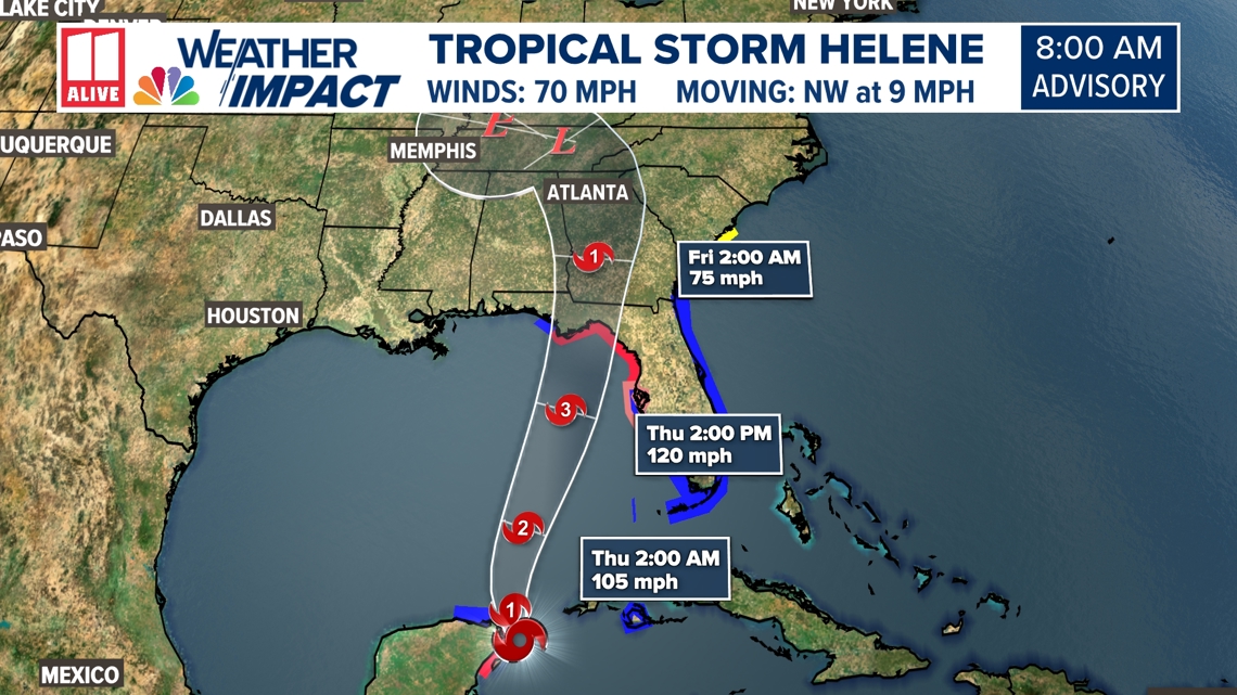
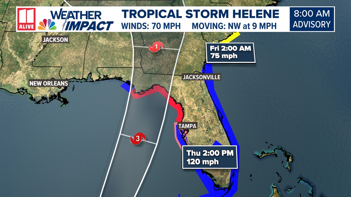
Helene is forecast to quickly intensify as it emerges in the Gulf of Mexico, becoming a major hurricane before landfall late Thursday along Florida's Big Bend region, not far from Apalachicola. In anticipation of the storm's impacts, Georgia's governor issued a State of Emergency to free up resources to respond to Helene-related impacts.
11Alive has issued a Weather Impact Alert for Wednesday PM for pre-Helene tropical downpours, then for Thursday and Friday in north Georgia due to impacts from Helene.
Download the 11Alive News mobile app and turn on alerts to get the latest updates on the storm's track from our team. Stream extended forecasts and live radar on the 11Alive+ streaming app, available on Roku, Amazon Fire and Apple TV.

Helene latest track
Helene is forecast to move into the Gulf as a tropical storm, then strengthen to a Category 3 Hurricane before making landfall along the panhandle of Florida by Thursday evening or early Friday.

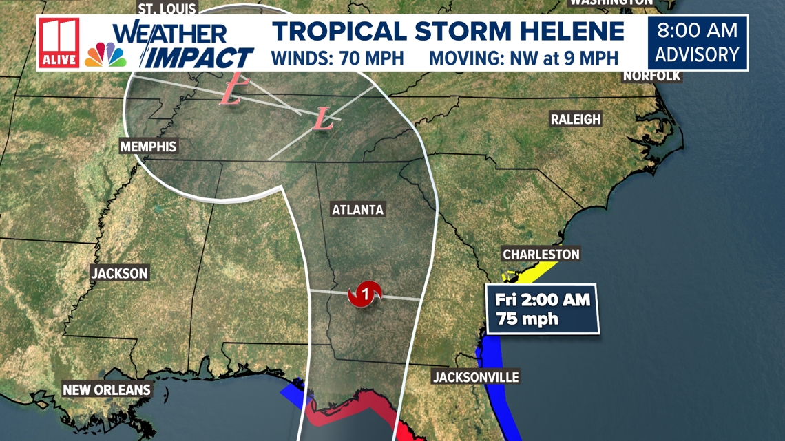
The storm is forecast to weaken as it moves northward through the state of Georgia, but depending on its strength and track, it could still have huge impacts on the area. It may maintain near tropical storm strength passing through north Georgia.

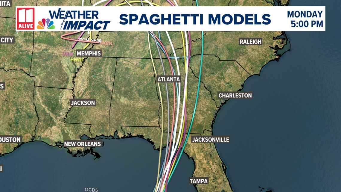
Helene spaghetti models:
It's still too early to be 100% confident in this track, but the models have been consistent so far. They are very similar in placement of the low as it approaches the coast. The spaghetti models are pretty similar to the NHC track.

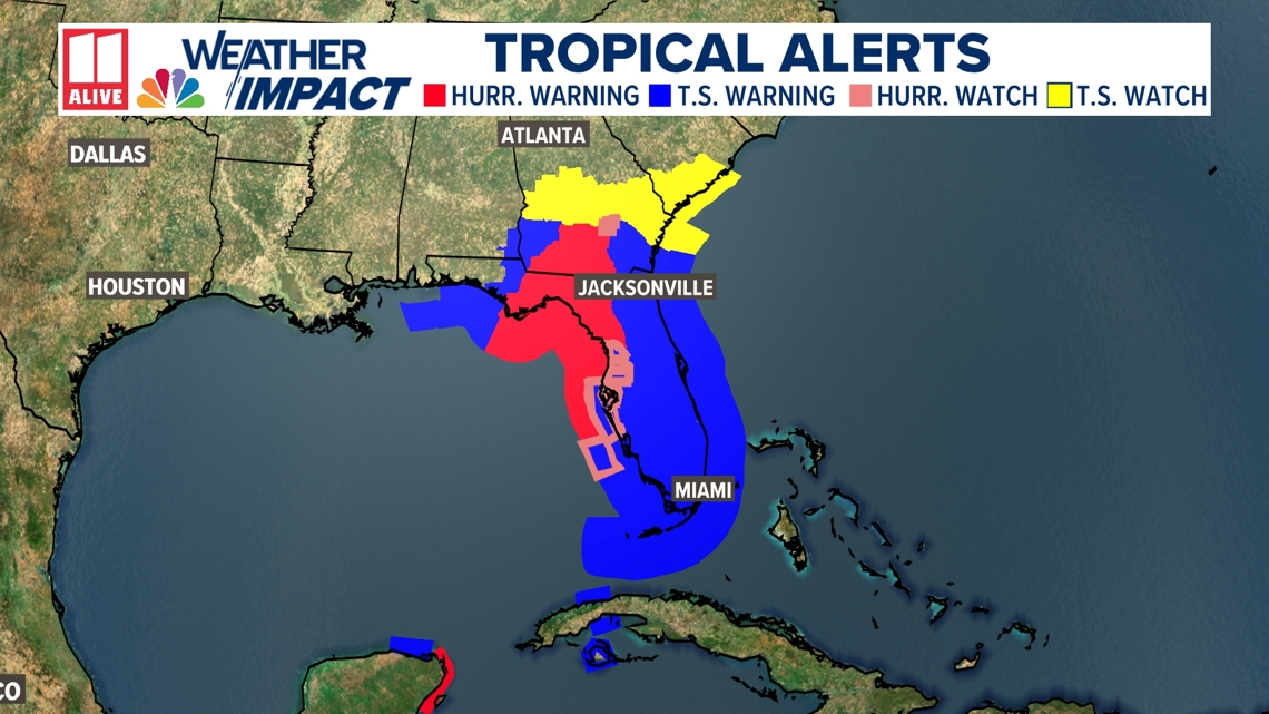
Watches and warnings:
Hurricane Warnings and Tropical Storm Warnings extend inland into south Georgia, and Tropical Storm Watches have been extended north through Macon. Upson county is included in the Tropical Storm Watch.

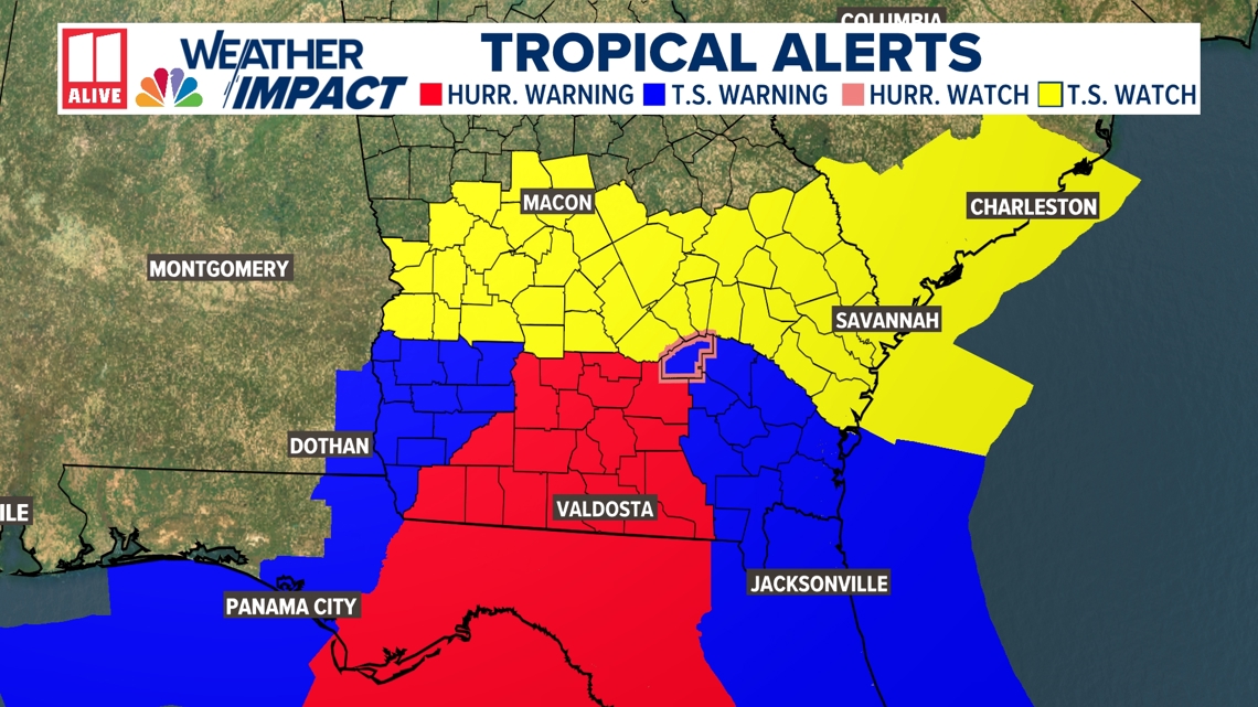
Hurricane Warnings are in effect from the Anclote River to Mexico Beach, Florida, as well as portions of the Mexico coast, including Cozumel.
A Tropical Storm Warning is in effect for the Florida Keys, Flamingo to Anclote River, including Tampa Bay, the Atlantic coast from Flamingo, Florida, northward to Altamaha Sound, Georgia, Lake Okeechobee, the Dry Tortugas, and portions of the Yucatan Peninsula and Cuba.

We will be monitoring all of these potential impacts this week and narrowing down all of these risks. It will be determined by the intensity of the storm, the speed of the storm and the track of the storm. If the system tracks east of Atlanta, our impacts would be less. If it tracks west of Atlanta or through Atlanta, we would see more impacts.
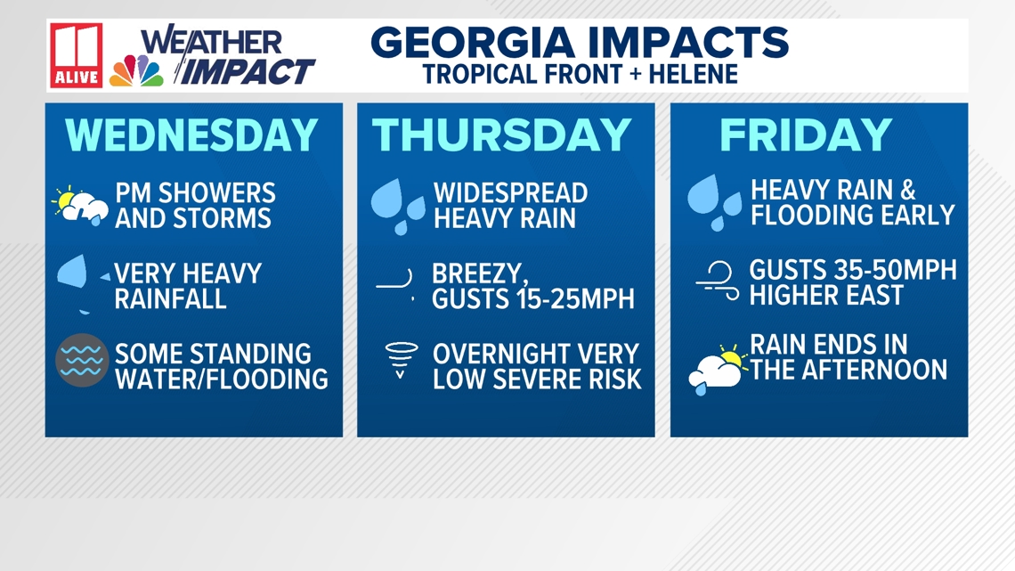
Georgia Impacts
We have issued an 11 Alive Weather Impact Alert from late Wednesday through Friday for impacts expected in north Georgia.
You can read more about them here: 11 Alive Weather Impact Alert Issued.

Interactive Helene Radar
Click here for the interactive radar tracking Helene.